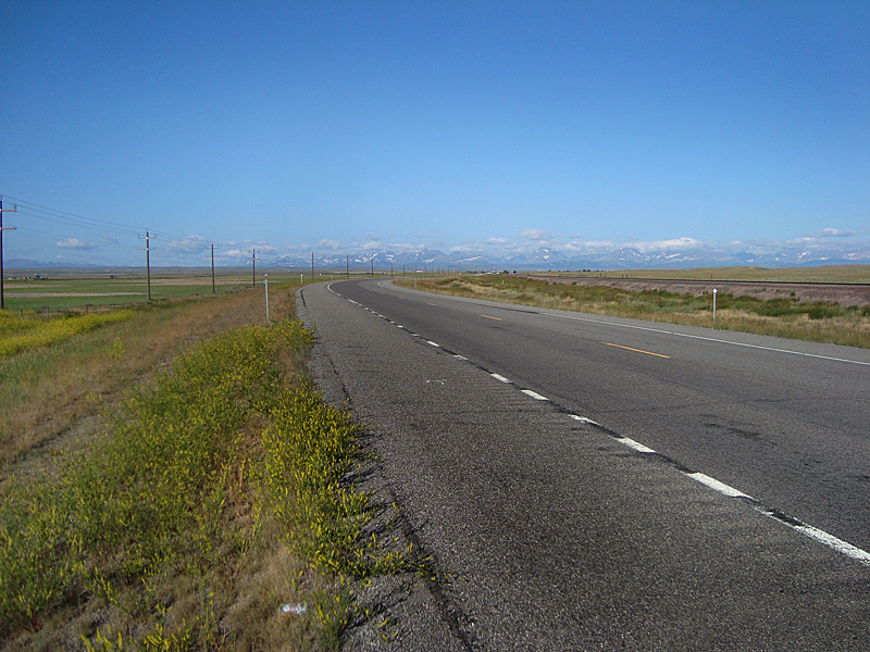
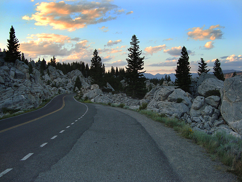
July 12 – 420 miles - New Milford PA to Daleville VA. Met the group at the New Milford PA exit of I 81 and we were off. We rode the length of I 81 our first two days, to Rt. 40 in Tennessee. The first day took us through PENNSYLVANIA, WEST VIRGINIA, MARYLAND to DALEVILLE, VIRGINIA – our first overnight stop – . I stayed previously at the Howard Johnsons there for several of my hiking adventures, so I suggested that to the group and that’s where we stayed – 100 yards from the Appalachian Trail. We enjoyed the refreshing pool after a long ride.
July 13 – 407 miles- Daleville VA to Manchester TN.I 81 to I 40, then south on I 75 through Chattanooga, touched Georgia, the up I 25 to Manchester.
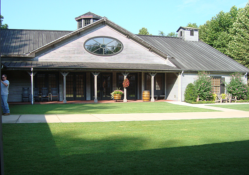
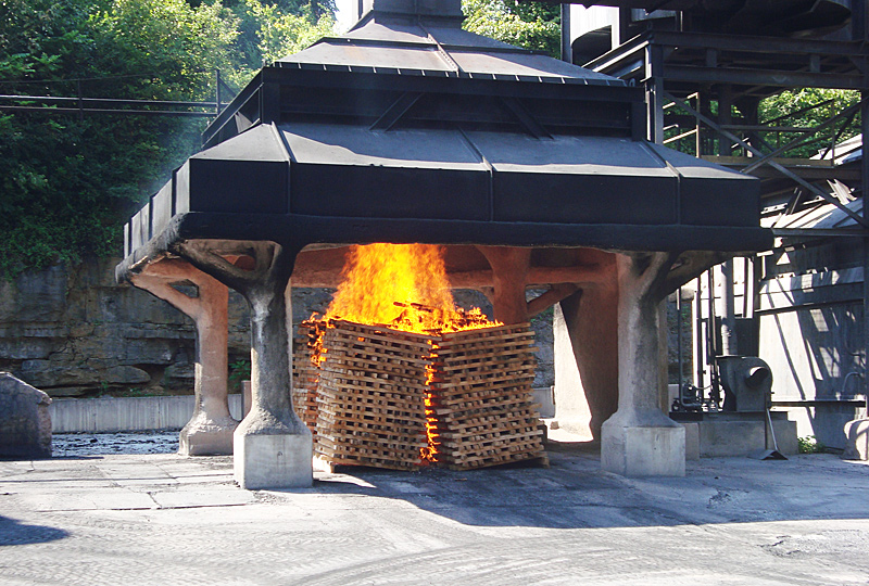
July 14 – 185 miles – Manchester TN to Jackson TN. Two-lane roads through beautiful Tennessee countryside to Lynchburg – and the JACK DANIELS DISTILLERY tour. The distillery is a fine example of good old-fashioned American craftsmanship, quality and pride and was a most interesting tour even though I don’t drink Tennessee whiskey. After the tour, we lunched in a small diner in Lynchburg followed by an ice cream shop dessert. It was hot – nearing 100 degrees, so most of us soaked and put on our cooling vests. Cooling vests soak up about two quarts of water and cool the wearer as the water evaporates – they work very well. Their cooling effect lasts for 2 to 3 hours depending on outside temperature and riding speed (wind.) We then dodged a light rain shower by ducking under a church’s carport, and ended up in Jackson TN for the night.
July 15 – 454 miles – Jackson TN through Arkansas to Sulphur Springs, Texas. Hot and Hotter. 105-110 degrees. Great pot roast dinner, fun waitress at Burton’s Restaurant.
July 16 – 575 miles – Sulphur Springs TX to Tucumcari, NM. Hotter still – 110-115 degrees. Through Dallas and Amarillo Texas. Drought and heat effects evident. Cooling vests make the heat almost tolerable. Drink a lot at fuel stops, wet down our vests. Motel pool warm like bathwater.
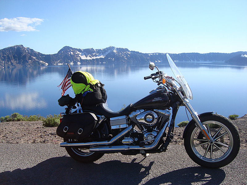
July 17 – 326 miles - Tucumcari NM to Gallup NM. Super heat continues. Thunderbird Harley Davidson in Albuquerque NM – Huge dealership, lots of bikes and big service department. Snacked at their fund-raiser and met some real characters. Had lunch in downtown Albuquerque at Cecelia’s Mexican restaurant. ( I had a plain burger and fries.) Very interesting place, though. Rode along and crossed CONTINENTAL DIVIDE in New Mexico.
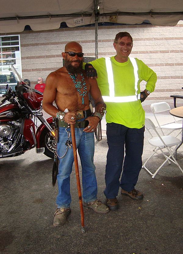
Despite belt-full of knives and fearsome appearances, this Harley rider was a gentleman. A fellow Free Spirit.
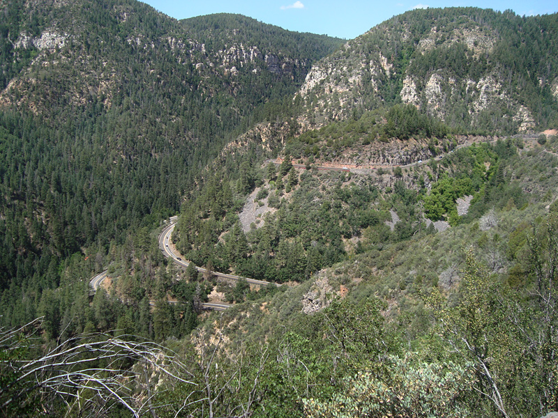
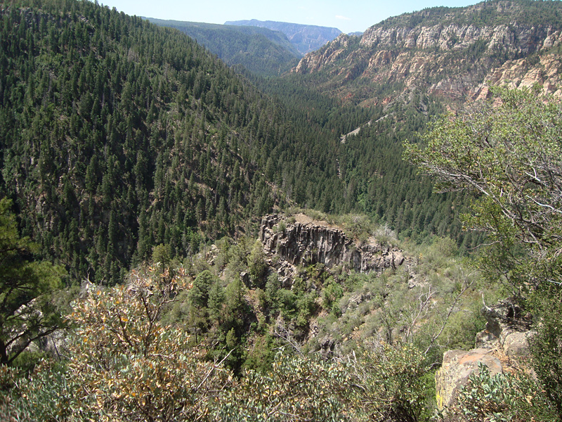
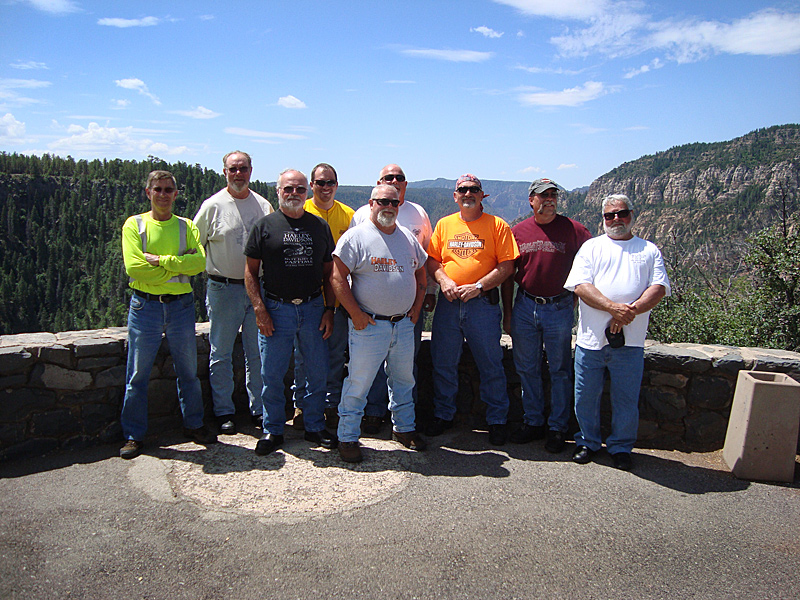
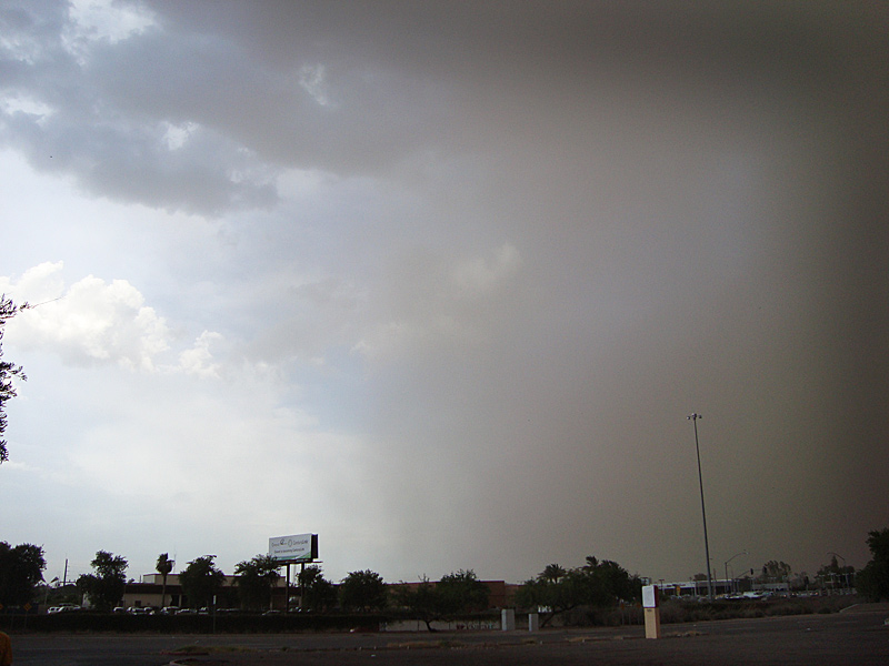
July 18 – 340 miles – Gallup NM through Oak Creek Canyon and Sedona to Phoenix Arizona. The Canyon and Sedona did not disappoint – they were beautiful. Riding the twisting roads through the canyon was great fun though many photo opportunities were passed up. Back to the interstate, we arrived in Phoenix just in time to experience a dust storm. After the storm, I walked to McDonalds past two homeless persons’ cardboard “residences”, closed businesses and blight. Evidently we were not in the best part of town.
In Phoenix, I split from the group and go off to continue on my own – my trip – my way.
The original plan was to ride 300 miles a day, more or less, with a Harley (HOG) group to San Diego, spend a few days there then head back via the Grand Canyon and Colorado’s Rocky Mountains. Indeed, I started out with that intention. I was riding with a really great group of guys and truly enjoyed their company, but I did not enjoy the dynamics of the group ride. Quietly, internally, I felt I was missing too much because I wanted to stop and see more places, meet and talk to more people, take more pictures, ride fewer interstates and more back roads, slow down – see America the Beautiful up close and personal from the seat of my Harley - like I did in ’09. So, now, My adventure begins……………
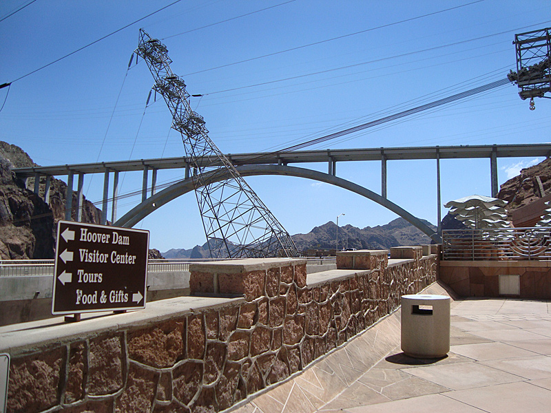
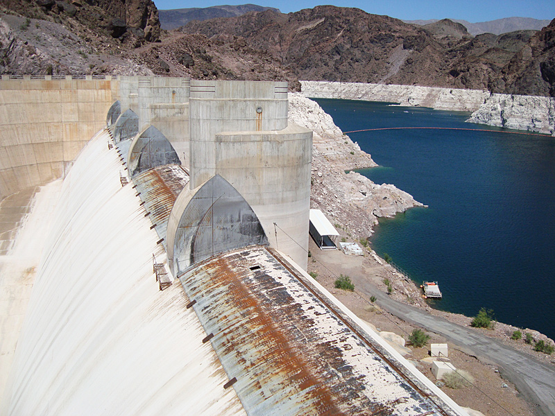
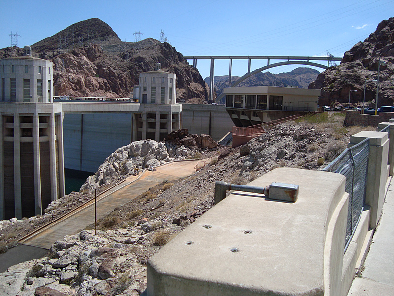
July 19 – 327 miles – Phoenix AZ to HOOVER DAM and Nevada, to Kingman, AZ. The heat is on – my thermometer registering a blistering 118 degrees. The bike runs fine, though, and I survive thanks to my cooling vest . It is so hot, I have to use my spare water to refresh it between gas stops. Highway 93 is extremely windy also. My notes for those first few days were blown out of my saddlebag along with my HOG trip map somewhere in Arizona, on my way to Hoover Dam, so the mileages for those days are close approximations from Google Earth. Hoover dam is grand – an amazing engineering marvel to behold. The new bridge over the chasm is another engineering masterpiece. The effect of the regions drought and ever increasing demand for water and power is evident on the low level of Lake Mead and at the dam. The effects of 911 can also be seen in the form of roadblocks, screenings and other tight security measures in place to protect this vital structure.
Spillway towers open at top – back wall of dam, (dry) boat launch ramp, new visitor center and bridge.
A major traffic accident on Rt. 93, returning from Hoover Dam, brought traffic to a dead stop for 3-1/2 hours in the desert heat. I met and talked with three guys from Switzerland that were touring America. They put Bryce Canyon and Zion National parks in Utah on their itinerary after talking with me about America’s west and its scenery.
July 20 – 414 miles – Kingman AZ through MOJAVE DESERT, along base of SIERRA NEVADA MOUNTAINS on US 395 (CA) to Bishop, California. Past Sequoia and Kings Canyon National Parks, and Mt. Whitney. Spectacular snow-capped mountains seem improbable given the temperatures in the 100’s. Improbable, but so beautiful. Crossing into California at Needles, the first thing I notice is the increase in gas prices – the first place I’ve seen regular at $4.20 a gallon. (It’s been $3.50-3.60) The heat I’ve come to expect. Met a nice lady at the desert crossroads of Kramer Junction (CA58 & US395) running a C-store that missed the lush greenery and moderate temperatures ‘back east”. Her husband was stationed at nearby Edwards Air Force base.
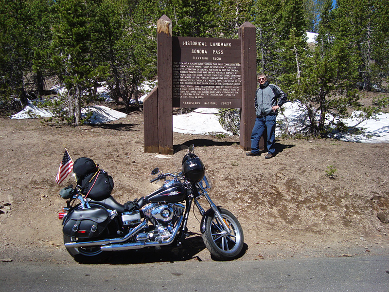
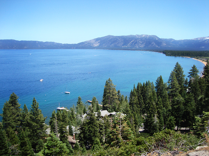
July 21 – 315 miles – Bishop CA, Through Mammoth Lakes and along Yosemite National Park, up and over Sonora Pass (9643ft.), through Monitor Pass (8314 ft.) along the west shore of LAKE TAHOE over the Sierra Nevada Mountains to quaint little Quincy California. At Sonora Pass summit I met a couple riding a Honda Gold Wing from Guatemala. They had ridden 11,000 miles so far and intended to go to Nova Scotia before turning around. Now, that is a trip. I told them also of my two favorite parks, Zion and Bryce, and they hoped to visit them on their return trip.
California has two main attractions to me – its many mountains and its scenic coast. I’m loving this ride. Lake Tahoe caution: Tourists mixed with California drivers in this highly congested area can be a deadly mix. Two times through here – two very close calls.
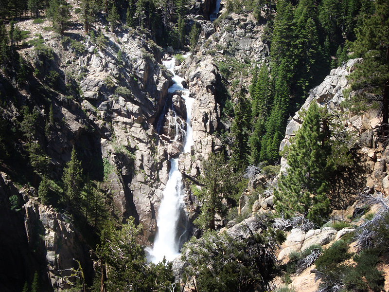
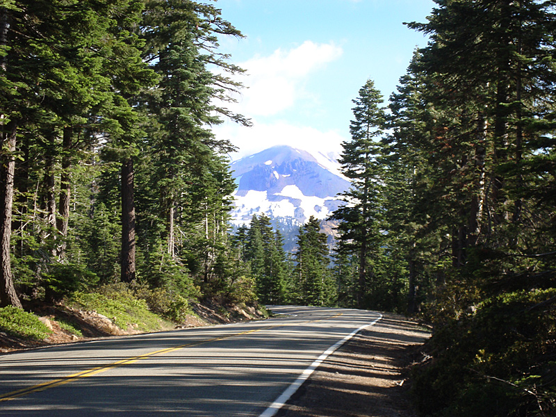
July 22 – 291 miles – Quincy CA through Lassen Volcanic National Park, over Salmon Mountains, through Trinity Alps Wilderness to PACIFIC COAST at Arcata, CA. Volcanoes have always fascinated me and Lassen did not disappoint. Well, except the trail to its main feature – Bumpass Hell, was closed and under several feet of snow. But many other volcanic features were easily seen. The ride over and through the mountains of California was very exciting with many hairpin turns, mountain climbing switchbacks and awesome scenery. Arriving at the coast, it was much cooler and refreshing with the smell of salt in the air. This has been my kind of ride.
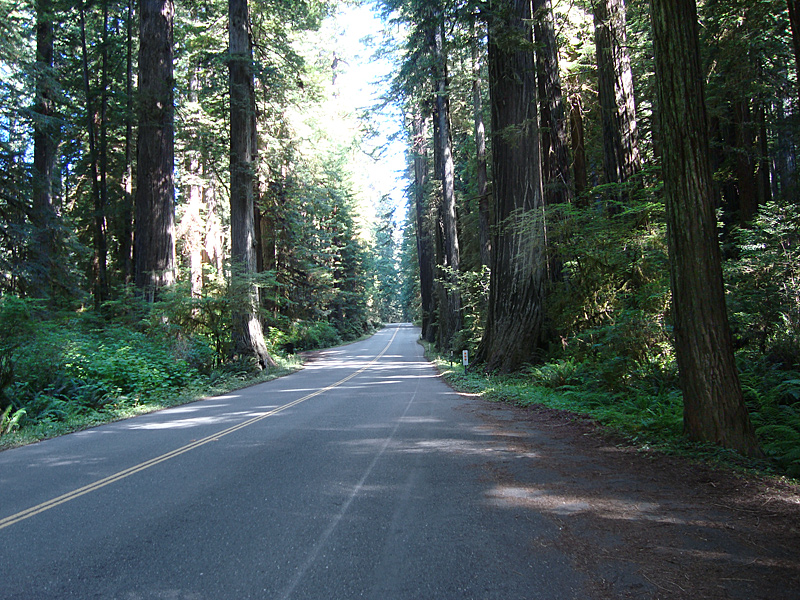
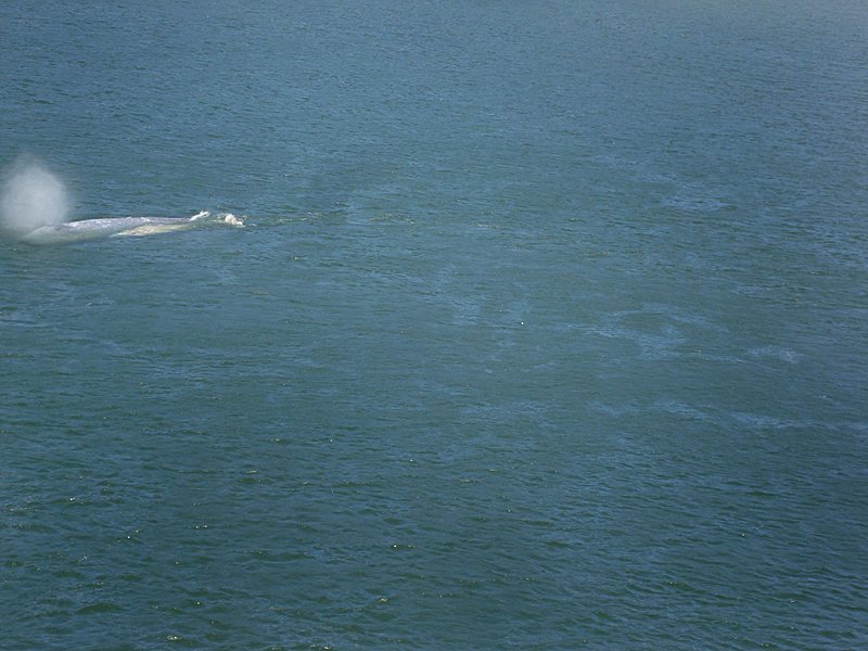
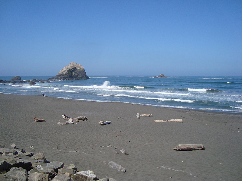
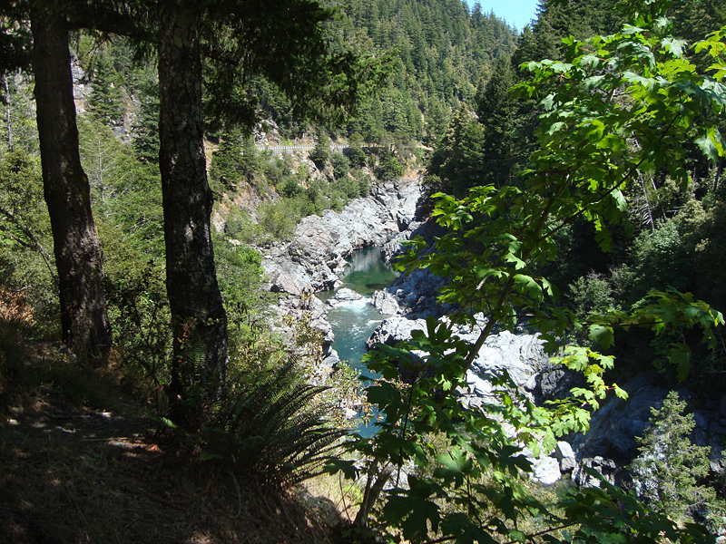
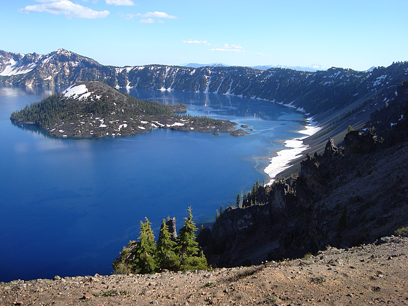
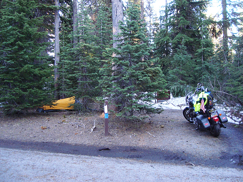
July 23 – 302 miles – Arcata CA (on the coast) Route 101 through Redwood National Park and CA Forest then into Oregon along the Rogue River to Crater Lake National Park (camp.) A most refreshing ride along the California coast and highway 101, through indescribably spectacular Redwood forests, then a most unexpected event – a gray whale and her calf swimming in Klamath Bay right under a highway bridge. Met a nice biker riding a beautifully restored 1987 Harley along the Illinois River heading into Grant’s Pass , Oregon. Rode along the Rogue River Gorge into Crater Lake National Park. I set up camp in a snow-filled campsite, then rode around Crater Lake. The park had just today opened the road around the lake, which had been closed because of snow blocking it. I met and talked with many nice people at the campsite and petted my neighbor’s beautiful Yellow Lab. Dinner at the Lodge I met three other long-distance bikers from Germany on their BMW’s . They were impressed with America’s many scenic wonders and the size and vastness of our wilderness areas.
Crater Lake and its Wizard Island – America’s deepest lake formed when Mt. Mazama’s volcano blew up some 7,000 years ago.
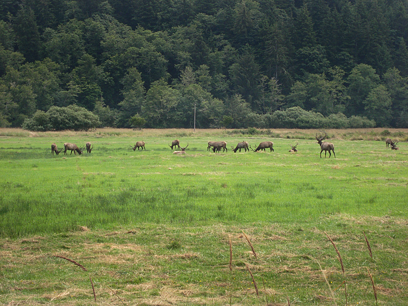
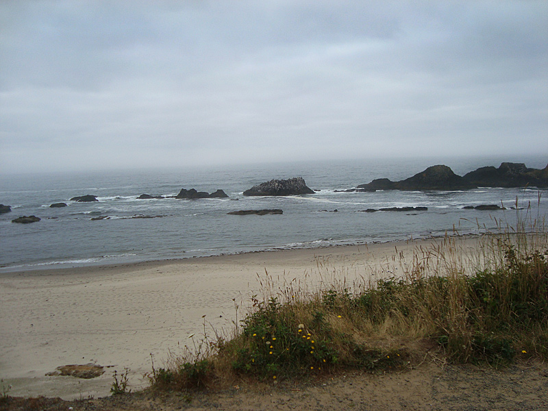
July 24 – 297 miles – Crater Lake camp to Lincoln City Oregon on the coast. Another spectacular day. After a breakfast of pastries and cookies from Crater Lake’s camp store, I headed into the Umpqua wilderness, over the mountains along various rivers – what beautiful riding. I ended up back on the Pacific coast at Reedsport, then rode the coast highway 101 north to Lincoln City where I spent the night. In a field off 101 I came across an elk herd. At lunch I met an older fellow riding his vintage Triumph to Mexico for a vacation. Two other Harley riders and a young guy on a BMW pulled in and we all compared notes on bikes and rides over lunch. The Oregon coast was beautiful in its ruggedness, but chilly, foggy and damp – typical weather according to the locals. I enjoyed a very different and tasty dinner in a Tai restaurant.
Later, in a Walmart parking lot, I met a very young man (Said he was 18 – looked 16) panhandling with his dog. After I talked to him for a while, I really wished I could have spent more time with him to try to get him to see the folly in his plan – leaving home and basically running away to see America with only the clothes on his back, his dog and a few bucks in his pocket. But it was not to be, so I bought his dog some food and some personal necessities for him as an elderly lady gave him a $20 bill. What little I did talk to him, he said I reminded him of his father – the reason he left home. Young kids are not burdened – or blessed – with years of worldly experience and tend to be way too optimistic. Reluctantly, after helping him what little I felt I could, I moved on.
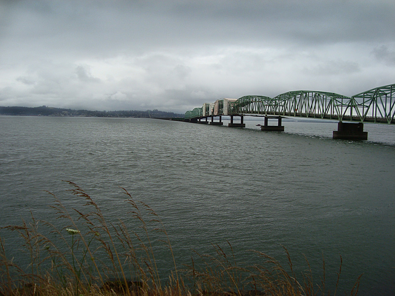
July 25 – 367 miles – Lincoln City OR to Yakima, Washington. It was cool and damp enough that I wore my jacket riding. Had a hearty breakfast in the Cow Belle Café, Rockaway Beach OR. Packed with friendly people and a friendly, curious local cop, I enjoyed great conversation along with my meal. I rode the Coast Highway to Astoria, crossed the bridge and the Columbia River Bay into Washington state. I followed the beautiful Columbia River for a while, through many fruit farms and cherry orchards, then headed northeast to Mount Rainier National Park. As I entered the park, I could not see the mountain at all. The entire area was socked in a misty fog. I started up the mountain and it got colder as I went higher – very cold. I stopped and put on all my cold weather gear and still shivered – my thermometer reading 40 degrees as I neared the 5,430 ft. Chinook Pass on Mt. Rainier. The road was wet with mist and snow melt. At the pass, I met a man from Michigan that was traveling around America, camping in his pickup truck as he went. He was making PB and jelly sandwiches and about to take a nap as I moved on. Once down from the mountain’s flank, the sun came out and it warmed to the mid 70’s. I stopped shivering. Looking back where Mt. Rainier was, I could see it was still enveloped in swirling clouds. It was a very scenic, most enjoyable ride to Yakima.
Astoria-Megler bridge over Columbia River Bay between Oregon and Washington. At 21,474 ft. long (4 miles) it is the longest continuous truss bridge in America. It was being painted as I rode over it. Photo from Washington side.
July 26 – 359 miles – Yakima Washington through Wenatchee Valley, along the Cascade Mountains to Grand Coulee Dam, through Spokane WA, to Newport Washington on Idaho’s border.
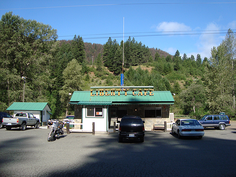
I was seeing so many new and beautiful places and meeting so many nice people, my spirits soared as I rode north from Yakima through Ellensburg WA and into the Wenatchee Valley along the Cascade Mountain Range. It turned out to be extremely windy as I rode through a well-located wind farm in a mountain valley. I stopped for breakfast in Liberty, at the café with the same name and it was the best breakfast of the entire trip. A plateful of golden brown hash brown potatoes, a generous slice of ham and two done-just-right eggs with buttered toast. But the best part of it was the genuine interest the patrons and staff showed in my adventure when they saw me pull in with PA plates on the Harley.
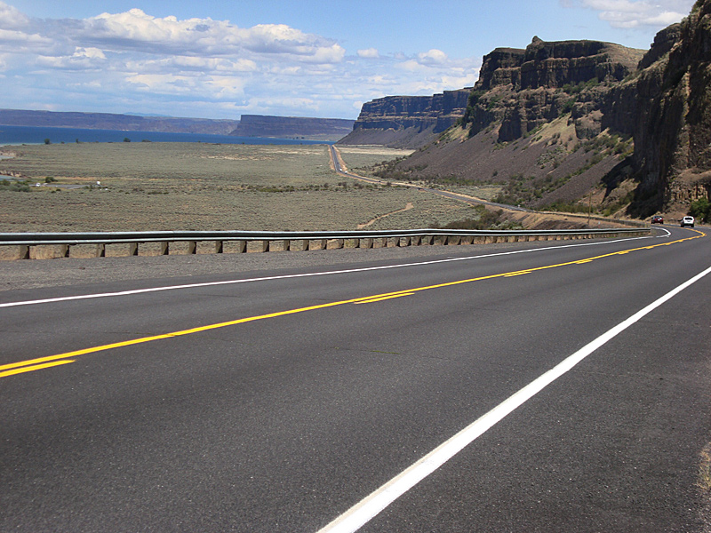
I picked up Route 2 and broke away from the mountains, headed into Washington’s plains and farmland. Traffic was nearly non-existent as the nearly flat and very straight roads went to the horizon with seemingly endless farmland and wheat fields beside it. Between Coulee and the Grand Coulee Dam I rode with Banks Lake on one side and rock ledges on the other and Steamboat Rock in the distance.
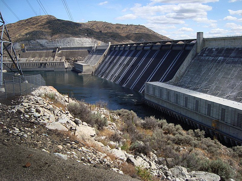
Grand Coulee Dam was impressive. It is the US’s largest electric producing facility and one of the world’s largest concrete structures. It was built after much debate over whether or not it was a worthwhile project. I plan to ride Route 2 across Northern America, for the most part, since I’ve not experienced that road before. I ran into horrible traffic in Spokane – one reason I avoid big cities as much as I can. At the motel in Newport I met and spent time with a nice group of six bikers on a vacation ride around the Northwest. Pizza delivered to the motel quaffed down with a large cold beer was a supper treat.
Best breakfast coupled with very nice patrons and staff made this stop most pleasant. Diner was packed, though it was truly in the middle of nowhere.
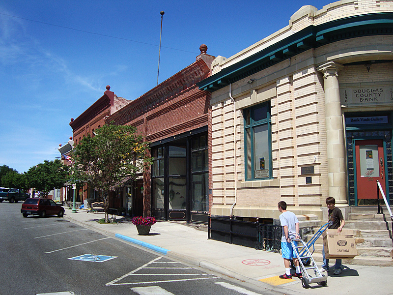
Want to buy a bank? It’s for sale – as is a good part of this sleepy little Douglas County farm town. Proprietor of the hardware store/ice cream shop/nick-knack shop and I had a long talk about the area’s lack of ability to retain young residents.
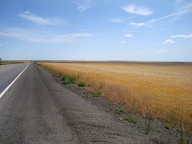
Route 2 stretches straight to the horizon and beyond with nothing but wheat and farmland on either side. Trees are virtually nonexistent.
Banks Lake, Steamboat Rock and impressive rock ledges make for an interesting ride to Coulee, WA.
Grand Coulee Dam, WA. Largest electric producing facility in U.S. and one of largest concrete structures in the world. Water flowing over the dam makes parallel white lines on the face of the spillway.
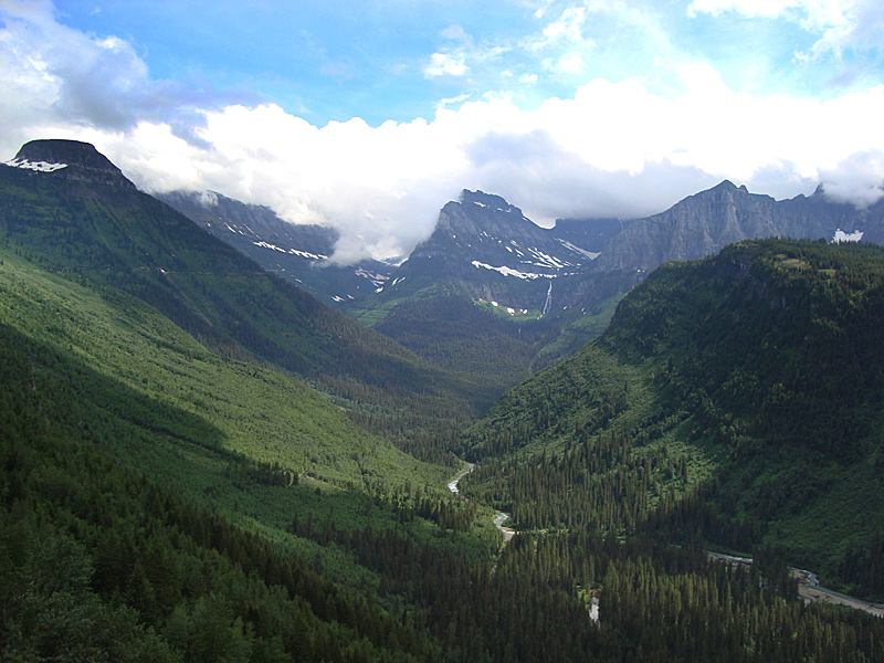
July 27 – 337 miles – Newport WA through Idaho into Montana’s Glacier National Park, cross the CONTINENTAL DIVIDE, to Browning, Montana.
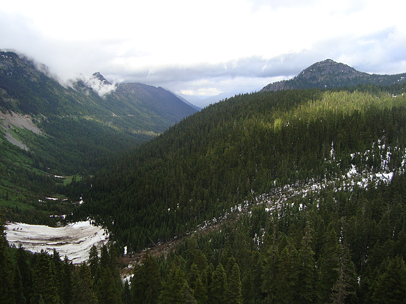
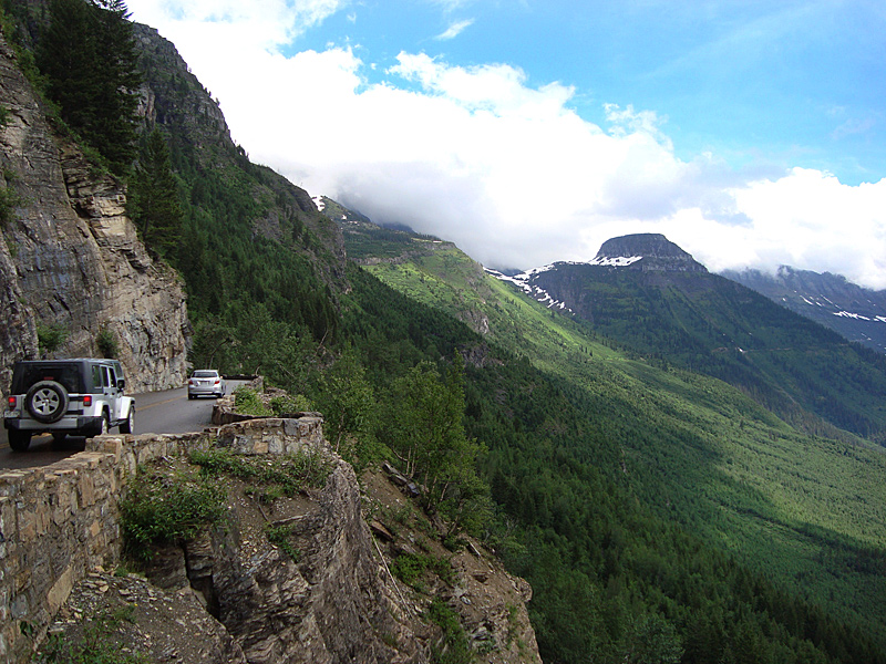
Morning along Idaho’s Priest River valley was spectacular. Except where it went through towns, Route 2 was two-lane 65 MPH with many turnoffs, driveways and intersections, but the open countryside and lack of view obstructing trees made it possible to see road hazards a long way off. I lunched in Troy, Montana and marveled at the scenery as it wound into the Rocky Mountains. At Glacier National Park, I took the Highway to the Sun over the continental divide through the park. The attendant at the booth told me the road was OK except for some construction. I rode past Lake McDonald and started climbing into the mountainous park.
Last winter’s snow caused lots of avalanches and road damage which they were repairing. Much of the road had been ripped away and was temporarily replaced with packed dirt. There are few if any guardrails along the road, none at all in the avalanche areas, and many precipitous drops of hundreds of feet off the road’s edge. This coupled with the cloudy mist that turned the dirt into mud, made for the most dangerous, thrilling, hairy riding of the entire trip. A touch of the throttle or brake sent the bike fishtailing or skidding. Much more adventure that I would choose to undertake, but, once there, I had no choice.
I hoped to get warm and enjoy a much-needed cup of coffee at the summit’s information center, after crossing the continental divide in the cold, wet clouds. The building was closed and rows of porta-potties lined the parking lot. I pushed on and descended the east side of the park. My bike was caked with mud but I survived the treacherous ordeal.
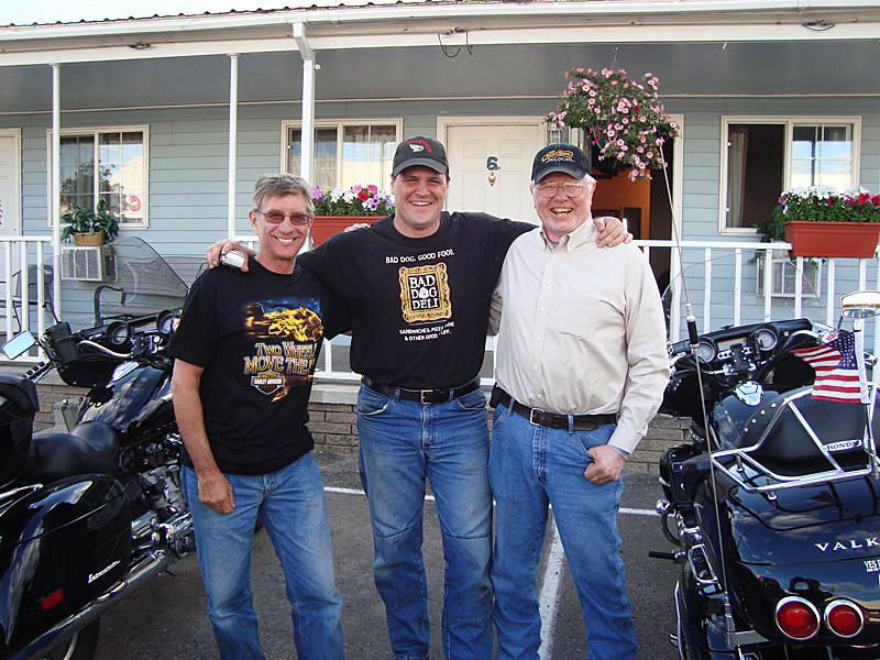
In Browning Montana there was only one motel in town. It was a nice place with nice rooms and a steep price – but it was the only game around. There I met two Honda Valkyrie riders – and one of them was broke down and waiting for parts. They were both great guys – great company – and made my stay there most enjoyable and memorable. Joe, from Kansas and Jim from Oklahoma, met at a Valkyrie riders club and get together and ride often. They helped me clean some of the mud off my bike but it was difficult, to say the least. The mud mixed with road tar had been baked on. Joe, a techie-computer whiz and Jim, a gun nut like me, and a pilot, both all around great conversationalists, made for a nice, relaxing night with a few beers. Also, the amount of help some strangers (now their friends) offered Joe to help repair his broken down bike and get him back on the road was downright heartwarming.
Al, Joe and Jim in Browning Montana. Joe and Jim are two of the nicest guys one could ever meet. They love their Honda Valkyrie motorcycles.
July 28 – 565 miles – Browning MT south through the western part of the state to Wyoming and YELLOWSTONE National Park, back into Livingston, MT for the night. Joe, Jim and I headed out for breakfast but a wrong turn made us part company. I headed south as they returned to Browning for breakfast and to await the needed parts to repair his bike. I had breakfast in Fairfield, MT, a quaint but thriving little farm town. As I rode south through Montana’s seemingly endless , nearly flat farmland and cattle ranches I had the Rocky Mountains in the distance off to my right. At Billings, I rode I 15 south to Helena, then got off at Helena, took 287 south and east to 90 at Three Forks, 90 east to Livingston where I secured a motel. Then I drove into Yellowstone National Park and Wyoming.
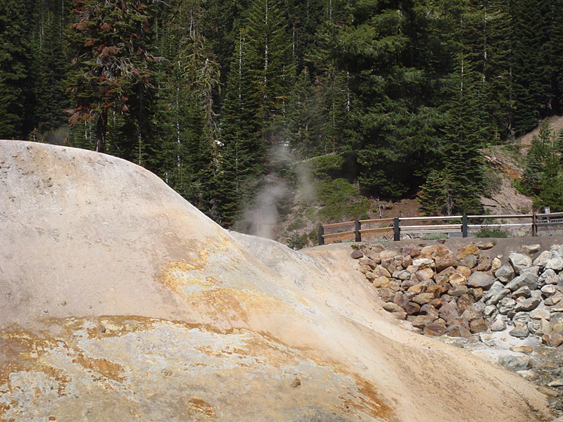
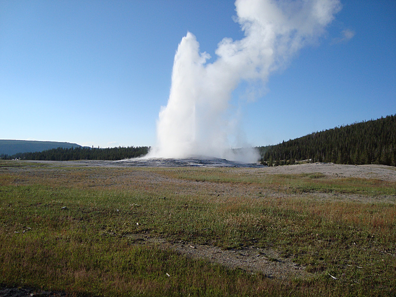
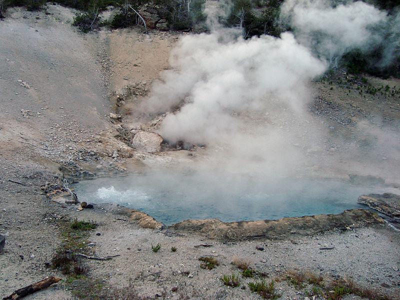
Traffic in the park was very heavy and slow. A park ranger directed us to keep moving as a bison grazed within five feet of the road’s edge – there was no safe place to pull off and bison can be unpredictable. I made it to Old Faithful just in time to see her blow. It was an impressive sight. Then I stopped at Beryl boiling spring – a spring with a pool of boiling water and a nearby sulfur vent. These two geologic features – among many more in the park - brought home the fact that all of Yellowstone was an active volcanic area and is believed to have had a pre-historic colossal eruption which formed many of the park’s unique and still active features in a giant caldera.
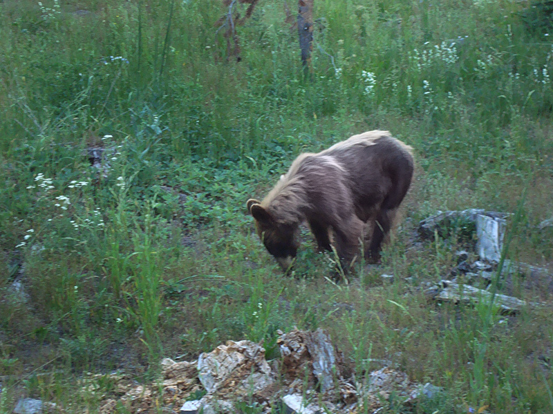
As I drove past the area of the earlier bison sighting, I kept my eye open, hoping to see the big creature again. I saw movement and pulled my bike to the edge of the road – it was a young grizzly bear, about the size of an average adult black bear – and I was just a few feet from it. I left the motor running as I snapped a few quick photographs, hoping no other grizzlies were in the immediate area, and made a hasty exit as it looked in my direction. Also, it was getting to be twilight and I avoid riding at night whenever possible. I stopped for a sunset photo then headed to town for gas and a scary ride 60 miles back to the motel in the dark.
Beryl Spring’s boiling water and sulfur steam vents – part of Yellowstone’s ongoing volcanic activity.
July 29 – 437 miles. Livingston MT northeast across Montana to Williston, North Dakota. Back on Route 2.
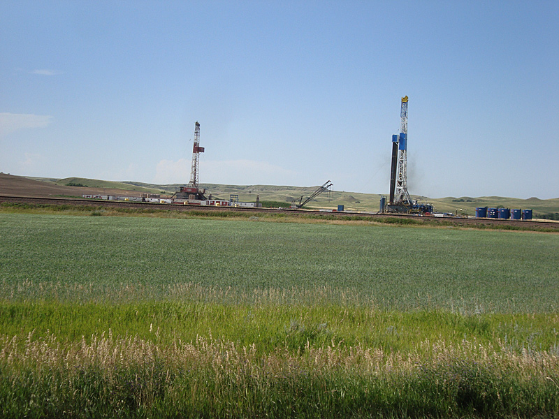
After breakfast, I intended to take Route 87 north back up through Montana from Billings. But there was a lot of heavy construction in the area and I missed a turn, ending up in Worden – a whistle-stop farming community. Not being anywhere near where I wanted to be, I took the opportunity to get back on I 90/94 and took it northeast to Glendive. I started looking for a motel in Sidney MT , then Fairview and was unsuccessful because all the rooms were taken by oilfield workers. I had to ride to Williston to find a room, then I got the last one available as more oilfield workers and surveyors came looking for rooms. Room prices reflected to heavy demand and short supply. In Williston, a large new hotel was under construction. It was evident that this area was undergoing some sort of oil boom. White pickup trucks labeled “Halliburton” were everywhere.
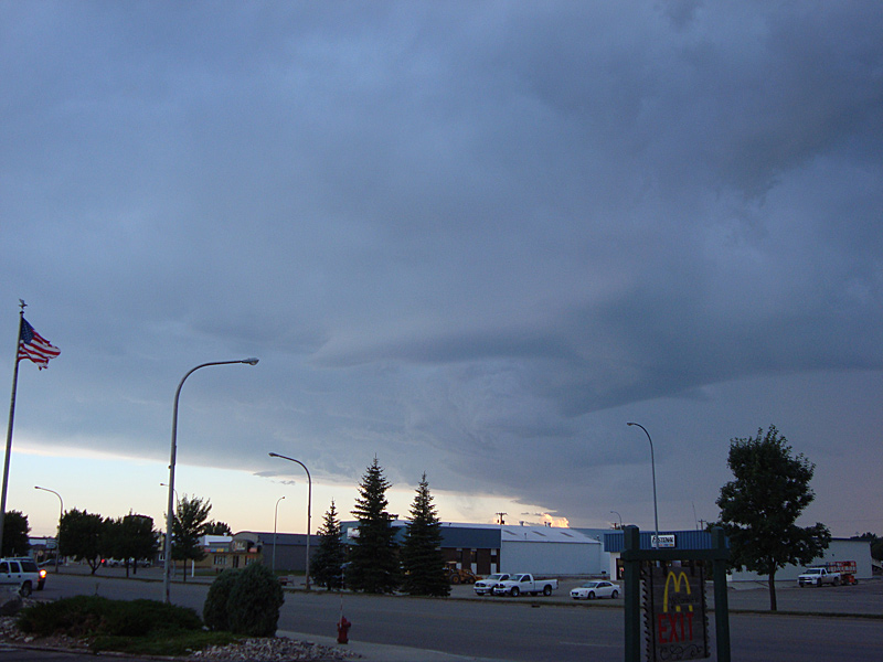
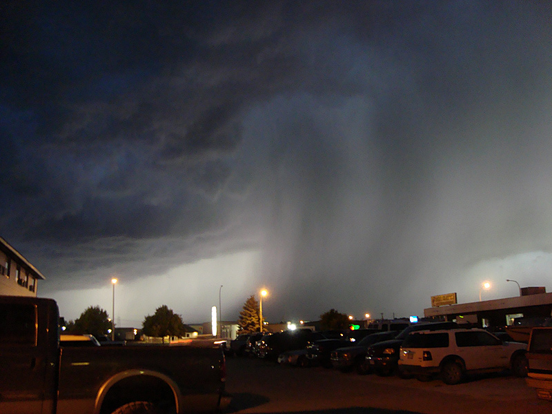
As I settled in for the evening and went out for supper, a thunderstorm popped up, briefly drenching the area.
Storm dumping rain on Williston ND. 30 minutes of thunder, lightning, heavy rain and wind, then it was over.
July 30 – 455 miles. Williston, North Dakota to Bemidji Minnesota.
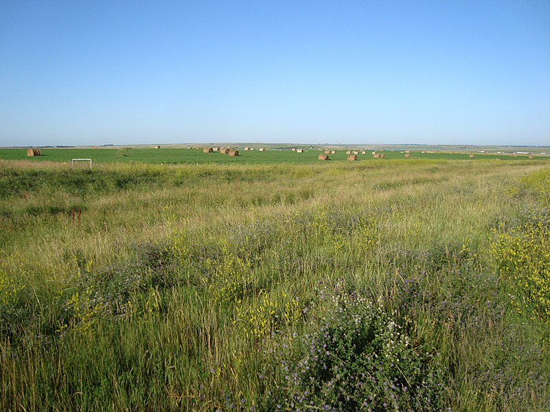
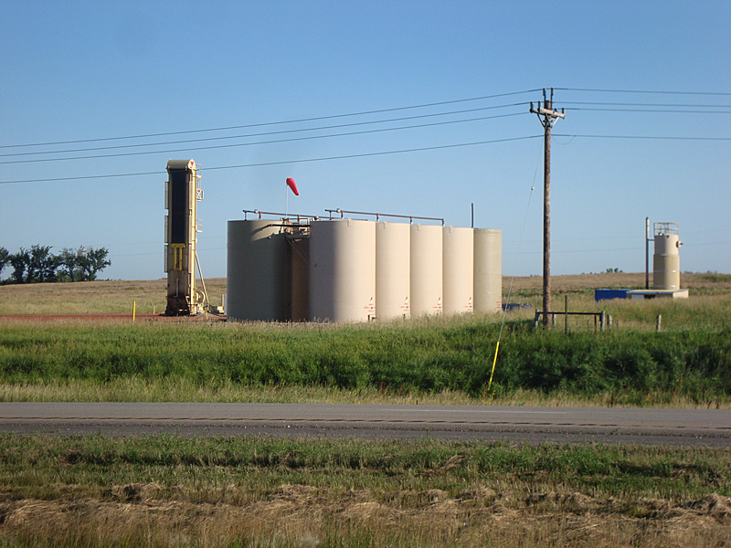
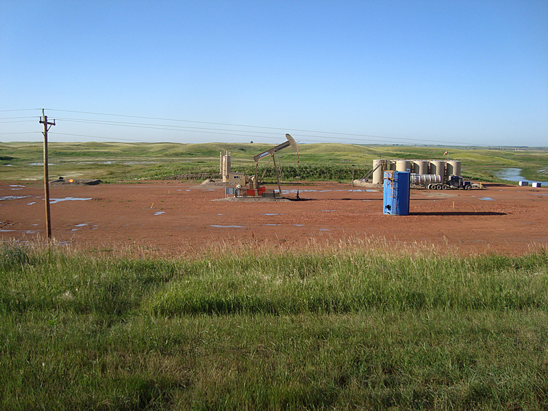
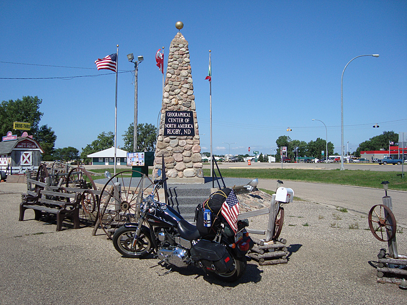
There is no question an oil boom is going on in northeast Montana and northwest North Dakota. The area is choked with big tanker trucks, little white Halliburton pickups, drilling rigs nearly everywhere, big trucks hauling construction equipment and dump trucks. Oil drilling rigs and pumps are seen everywhere, with adjacent tanks. Rail cars are tanker types. Gas is being flared off at many sites. Route 2 is covered with dust and dirt at every intersection. Just outside Williston, 30 to 40 portable trailer type housing units were set up by an oil company in a fenced-in field for its workers. Pipelines were being laid everywhere and a new rail line was just laid in to handle the oil shipments, according to one roughneck I spoke with. It was a fascinating area to ride through, traffic congestion notwithstanding. Around Minot ND, almost halfway across the state, the area started to return to normal, that is, no heavy presence of oil drilling activity. A but further along Rt. 2 there was a monument erected to mark the Geographical Center of North America in Rugby ND. Western Minnesota was very flat and becoming more and more wooded. Easy, but slightly monotonous riding.
When I got home, I read an article about the area’s oil fields. An excerpt and map from an 8/25/2011 24/7 Wall Street online article:
“Current production from the Bakken shale is about 360,000 barrels/day and there are those who believe that figure will reach well over a million barrels/day in another five years. The US Geological Survey estimates about 4.4 billion potential barrels from the Bakken. Continental Resources’ chairman suggests that the real potential is about six times that.
Whatever the production, the problem remains how to get the oil to market. More pipelines are needed to get the oil to somewhere other than the market hub at Cushing, Oklahoma. The Bakken’s crude competes with the heavy crude coming from the Alberta oil sands for pipeline space and markets. Rail and truck transportation currently haul most of the Bakken’s crude.
A substantial portion of the Bakken’s production is transported by rail, which is far more expensive than pipeline transportation. But the high prices for crude are boosting rail transportation from the Bakken to the Gulf Coast to around 100,000 barrels/day this year. Some analysts think that number could triple by the end of 2012.”
“Geological Center of North America Rugby ND” the monument reads. It and the appearance of nearby deciduous trees tell me I’m on my way home, leaving the magnificent west behind.
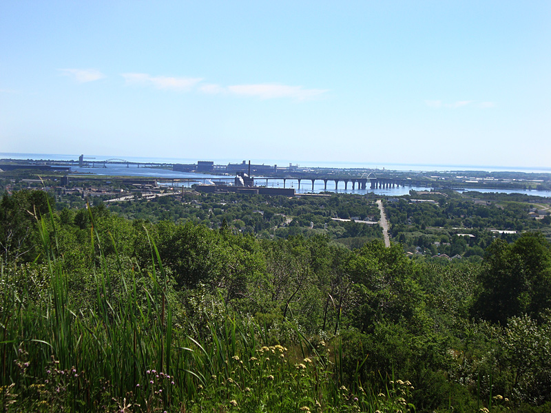
July 31 – 385 miles. Bemidji, Minnesota through the “Land of Lakes”, into Minnesota woods, through Deluth, touch Lake Superior shores, across upper Wisconsin, into Michigan’s Upper Peninsula (U.P) at Iron Mountain.
Leaving the wide open spaces of the West behind, cities and town get closer and closer to each other. Bemidji MN to Grand Rapids MN was the “Lake” district – but woods alongside Route 2 prevented many views – but there were a lot of turnoffs to this resort and that lake, etc. From there on it was heavily wooded with lots of timber industry evident, into Deluth – the Great Lake’s far western shipping port. It seemed Deluth was also the “Under Construction” capital of the Great Lakes region where the detours had detours. Two lane traffic at 55MPH seemed slow. It was pretty much the same wooded highway, few views across the northern tip of Wisconsin to Iron Mountain, Michigan. Iron Mountain was a paper mill town suffering from effects of the economic downturn while trying to adjust to diminishing paper business from newsprint and magazine papers. I found a great “home-style cooking” restaurant there, thanks to a motel owner’s recommendation.
August 1 – 468 Miles – Iron Mountain WI across the U.P of Michigan along upper Lake Michigan, across Mackinaw Bridge, to Jackson, Michigan.
Heading back east into its characteristic density of cities and heavy traffic, I wanted to avoid the Chicago area. Traffic through central Michigan was fast and intense on the 4-lane road.
August 2 – 592 miles – Jackson Michigan to New Milford PA – Home.
The weather forecast I got last night indicated this was the last nice day before a rainy period settled in, so I decided to push home on interstates and 4-lane roads. I rode the last of Michigan into Ohio, got on I 80/90, through Toledo and into Cleveland (more big city congestion and construction) where I 90 split off I 80/90, along Lake Erie, and continued east to Pennsylvania. To be different, and include New York, I rode I 86/NY17 across NY’s southern tier before dropping back into PA and home on I 81. The Harley was flawless in its performance and my Metzler 880 tires made the entire trip and then some with tread to spare. It was very cloudy, but I beat the rain home, ending a fabulous trip. America is indeed America the Beautiful, land of the free.